I got to Butler, and was dismayed to see that vandals have been busy. I just saw a Facebook post about another Mansfield City park being vandalized, Liberty Park in the Madison school area. Very sad to see. I was glad, however, that the ladies' room was still open.
It was nice weather for a ride. Not too cool, not too hot. I made my way onto State Route 95 and headed south. I stopped to take a photo of this creek, because it was so pretty with the sky reflecting in the s-shaped creek. Unfortunately the photo doesn't give the full effect.
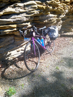
Traffic was light on SR 95 and that was good, because there were no shoulders marked. A couple of semi-trucks came the other way, but they slowed, and there was no issue. I got to Fredericktown without incident, where the google navigation was a little confusing. Luckily I spotted a bike/hike trail on the other side of the road and guessed I was supposed to take it. It was very pleasant. A section was cut out of rocks, which had eroded away over the years.
When the short trail ended, I was on a wide, empty road. Empty except for the heavy trucks that occasionally came my way. That street ended on State Route 13, just at the end of the divided highway section. I had to cross over the divided highway to turn left. At least there was a narrow shoulder, but there was also a rumble strip cut into the edge markings. I had to concentrate not to wander into the rumble strips. Traffic was fairly light, being the middle of the day.
When I got to Mt. Vernon, there were a lot of road closing signs. But they said "Local Traffic only - No Trucks", so I assumed a bike would be able to get through. When I got to the construction area, though, car traffic was coming through the one lane in only one direction. I moved over onto the sidewalk and rode through the parking lots of several businesses. This was pretty easy because the road was downhill. I got to the square in Mt. Vernon and decided it would be good to stop for lunch. I picked this place, thinking it would have healthy food.
The lunch menu was limited, they had a "happy hippie" wrap with kale and other vegetables and either scrambled tofu, sesame seed, or both. I chose just the scrambled tofu. It was sooooo gooooood!!!
I may come back when not on the bike, just for another one of those wraps. There is also a maker space next door that I'd like to check out.
I rode on to the old restored train station that serves as the Chamber of Commerce visitor center along the rail-trail. This is the meeting of two of the trails that make up the Ohio to Erie Trail. I rode past Ariel Foundation park, which is the site of a former PPG glass factory, and continued down another 8 or 9 miles to Mt. Liberty. I was starting to worry about getting home in time for "date night" with my husband, so I turned around and headed back. The trail is every so slightly downhill going north. I made better time going back.
When I got downown in Mt. Vernon, I wanted to avoid the road construction, so I went up Gay Street. This proved to be problematic. First, it was uphill. There was no bike lane, and cars were parked on the right with little room for the traffic, and no room for me. I ended up walking up part of the street onthe sidewalk.
I do not recommend this route. So I am still searching for a way from Butler to OTET!


No comments:
Post a Comment